The GIS for e-transportation
Why this e-transportation is essential?
-New student lost their way in main campus
-New student do not know where the nearest bus stop
-New student do not know the place in main campus
-Visitors do not know the flow of the traffic in main campus
This is the benefit outcome from the e-transportation:
Help navigated student and visitors in main campus
Help student locate the bus stop in main campus
e-transportation give much essential benefit to the user. The user can have supporting decision tool for user to know which nearest bus stop available in walking distance from the campus building.
By using GIS, e-transportation give an information of the bus services schedule to be arrive at that bus stop. This give a chance for the user to plan which bus stop to go for.
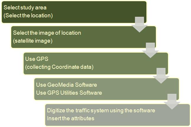
The methodology of the e-transportation development is as follows:

No comments:
Post a Comment